
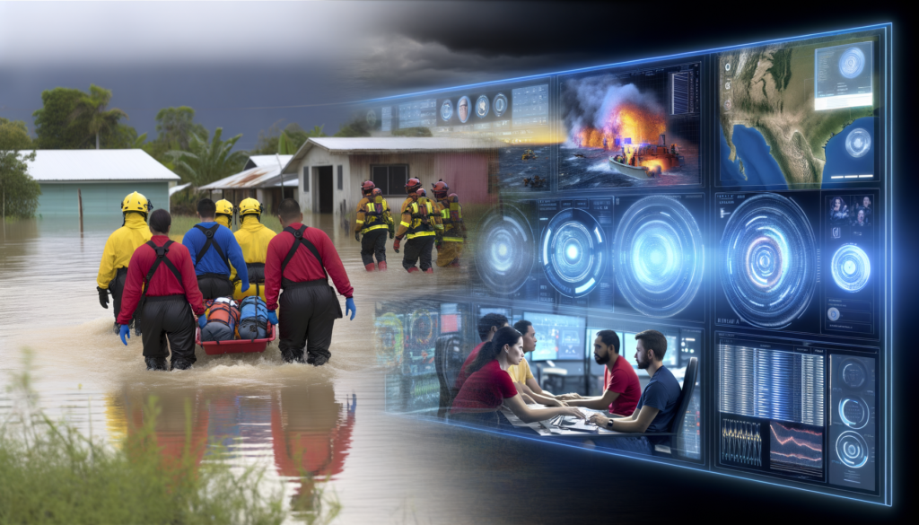
Civil emergencies such as natural disasters challenge societies globally. The advent of artificial intelligence (AI) offers groundbreaking potential to bolster emergency response efforts. This article delves into the transformative impact of AI applications in emergency situations, including predictive analytics for disasters like floods and earthquakes, optimizing search and rescue operations, and improving crisis management.
Redefining Emergency Management with AI
The advent of Artificial Intelligence (AI) has marked a transformative era for civil emergency response and disaster management. Its integration into the emergency management lifecycle—from immediate reaction to long-term recovery—embodies a paradigm shift towards more efficient, timely, and accurate responses. This chapter delves into the pivotal roles AI plays across various stages of emergency management, emphasizing its potential to revolutionize the field through predictive analytics and machine learning.
The immediate response phase is critical in minimizing disaster impacts. Traditionally, decision-making during this phase has been constrained by the lack of real-time information and the human limitation in processing large data sets swiftly. AI, however, transcends these limitations. Predictive analytics, a cornerstone of AI, enables authorities to move from a reactive to a proactive stance. By analyzing historical data, AI models can forecast disaster likelihoods, from natural disasters like floods and earthquakes to man-made crises, with remarkable accuracy. This predictive power allows for preemptive measures that can significantly mitigate damage. For instance, in flood-prone areas, AI can predict the onset and possible extent of flooding, prompting early evacuations and the prepositioning of resources, thus saving lives and reducing economic losses.
Once a disaster strikes, the focus shifts to effective resource allocation and management. This is where machine learning, a subset of AI, excels. It can analyze real-time data from various sources, including social media, IoT devices, and traditional media, to assess the immediate needs of affected populations. This analysis informs the prioritization and distribution of resources, such as water, food, and medical supplies, ensuring that help reaches those in need swiftly and efficiently. Machine learning algorithms can continuously learn from ongoing operations, adapting resource distribution as the situation evolves, thus optimizing the response effort.
AI also transforms search and rescue operations. Through the integration of drone technology and machine learning, search teams can now rely on AI to analyze drone-captured images quickly. This analysis can identify signs of survivors in disaster-stricken areas, guiding search and rescue efforts more precisely and reducing the time it takes to reach victims. The ability of AI to process and analyze images from drones dramatically enhances the efficiency of these critical operations, saving more lives in the process.
In the recovery phase, AI continues to play a crucial role. The analysis of data collected during and after the emergency provides insights into the disaster’s impact and the effectiveness of the response. Machine learning models can use this data to identify patterns and recommend improvements for future disaster response efforts. Furthermore, predictive analytics can assist in the planning of reconstruction efforts, identifying areas most in need of rebuilding and predicting future disaster risks to inform more resilient infrastructure development.
AI’s role in civil emergency management is not without challenges. The accuracy of AI predictions and analyses largely depends on the quality and quantity of available data. There’s also the ethical consideration in the deployment of AI, particularly concerning privacy issues and the potential for biases in AI algorithms, which could inadvertently lead to unequal resource distribution during crises. Addressing these challenges requires ongoing dialogue among policymakers, technologists, and civil society to ensure that AI’s integration into emergency management maximizes benefits while minimizing harms.
In conclusion, AI has the potential to redefine emergency management by enhancing the efficiency and effectiveness of response and recovery efforts. Through predictive analytics and machine learning, AI facilitates a move towards more proactive, data-driven decision-making. This shift not only improves immediate response actions but also informs better planning and preparedness for future emergencies. As AI technology continues to evolve and its integration into emergency management processes deepens, the potential for saving lives and reducing the impact of disasters looms large, heralding a new era of smarter, more resilient emergency response.
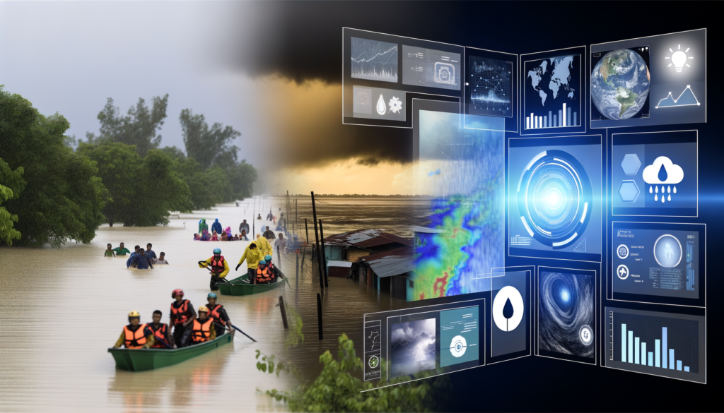
Building upon the foundation of how AI has revolutionized emergency management, we delve deeper into the specific area of remote sensing, an indispensable tool in disaster response that has been dramatically enhanced through the integration of artificial intelligence. The use of remote sensing technology, particularly satellite imagery, in the context of civil emergency management, leverages the eye in the sky to obtain critical, real-time information about disaster-stricken areas. This technological advancement is crucial for effective planning and executing relief strategies, and the infusion of AI into remote sensing has taken its capabilities to unprecedented levels.
Remote sensing technology captures imagery and data from the Earth’s surface using satellites or aircraft, providing invaluable insights into areas affected by natural disasters like floods, earthquakes, and more. When integrated with AI, the analysis of this data can be automated and enhanced, allowing for the identification of subtle changes in the landscape, anticipation of potential secondary disasters, and monitoring of disaster progression in real-time. AI algorithms are trained to process vast amounts of satellite data, extracting pertinent information that can be utilized for swift and informed decision-making during emergencies.
The primary advantage of satellite imagery analysis using AI is the ability to monitor large and inaccessible areas with ease. In the aftermath of a disaster, it’s often challenging to physically access affected regions due to damaged infrastructure, making satellite imagery crucial for initial assessment. AI-enhanced remote sensing can quickly analyze this imagery to identify the extent of damage, locate areas where people might be trapped, and detect changes in geographical features that may signal further risk, such as potential landslides after an earthquake or the breach points in a levee system during a flood.
Moreover, AI algorithms can process imagery over time to track changes and patterns, offering insights into the progression or resolution of a crisis situation. This capability is paramount for managing long-term recovery efforts, where sustained monitoring helps in understanding the effectiveness of relief efforts and planning reconstruction projects. The predictive aspect of AI, discussed in the preceding chapter, also plays a significant role here. By analyzing historical data alongside real-time inputs, AI models can forecast future disaster risks with remarkable accuracy, enabling preemptive action to minimize impact.
The integration of AI into remote sensing for emergency management also enhances the efficiency of resource allocation. By providing a detailed, accurate picture of the disaster’s extent and severity, these technologies ensure that resources are directed to the most affected areas, avoiding the waste of valuable time and supplies. Search and rescue operations benefit immensely from this technology. AI algorithms can prioritize search areas based on the analysis of satellite imagery, guiding teams to locations where survivors are most likely to be found, thus saving critical hours and increasing the chances of successful rescues.
Another significant advantage is the ability of AI to process different types of sensor data for a comprehensive analysis. Apart from optical imagery, remote sensing technology includes radar and LiDAR, which can penetrate cloud cover and provide valuable information even in adverse weather conditions, a common obstacle in disaster scenarios. AI’s ability to integrate and analyze these diverse datasets ensures a holistic view of the situation, vital for managing complex emergencies.
The advantages of employing AI in satellite imagery analysis for emergency management are clear: enhanced real-time monitoring, improved accuracy in damage assessment, efficient resource allocation, and effective planning and execution of relief and recovery strategies. As we move forward, the subsequent chapter will explore another critical aspect of AI in disaster management—the role of image processing. This process not only complements the remote sensing data by allowing for the quick interpretation of images but also plays a crucial role in assessing damage and identifying urgent needs, further underscoring the significance of AI in redefining emergency response for the better.
Building on the foundation laid by remote sensing technologies, the integration of artificial intelligence (AI) has catalyzed a transformation in how we process the vast amounts of data these technologies provide. Particularly in the realm of digital image processing, AI has emerged as a cornerstone for enhancing civil emergency response efforts. The significance of digital image processing in emergency scenarios cannot be overstated, as it enables the rapid interpretation of images obtained from remote sensing data. This rapid interpretation is crucial for assessing damage, identifying areas in urgent need of assistance, and deploying resources efficiently in the aftermath of disasters.
AI-driven image processing tools leverage algorithms and machine learning models to analyze satellite images and aerial photographs. These tools can automatically identify patterns and anomalies within the images that would be impossible, or at least extremely time-consuming, for human analysts to detect. For instance, in the event of an earthquake, AI algorithms can quickly sift through satellite images to locate collapsed buildings, cracks in infrastructure, and other signs of distress. This capability not only speeds up the damage assessment process but also ensures that help can be directed to the most affected areas without delay.
The role of image processing extends beyond the initial assessment to encompass continuous monitoring of disaster-stricken zones. Through the application of AI, changes in the landscape caused by ongoing seismic activity, aftershocks, or secondary hazards like landslides can be detected in near-real-time. This ongoing assessment aids in the adaptation of response strategies as the situation evolves, ensuring that relief efforts remain as effective as possible.
In the context of flood management, AI-driven image processing plays a pivotal role in identifying flooded areas, estimating water depth, and predicting the spread of water. By analyzing patterns in water movement and correlating them with historical data, AI models can forecast the progression of floods, enabling preemptive evacuations and the preparation of relief supplies. This predictive capability, which bridges the segue into the next chapter, marks a significant advancement in minimizing the impact of floods on human settlements and infrastructure.
Moreover, in the domain of search and rescue operations, AI-enhanced image processing has revolutionized the way responders locate and assist survivors. Drones equipped with high-resolution cameras can cover extensive areas much faster than ground teams. The imagery captured by these drones, when processed through AI models, enables the identification of heat signatures or color patterns indicative of human presence amidst rubble or in hard-to-reach areas. This advancement significantly increases the chances of finding and saving lives in the critical hours following a disaster.
The application of AI in image processing also extends to the management of resources such as water and food. By analyzing images of cropland and water sources from satellites, AI algorithms can estimate the availability of these essential resources, predict shortages, and identify the most efficient paths for distribution. Such insights are invaluable for sustaining survivors in the aftermath of a disaster, ensuring that aid is prioritized to regions at the greatest risk of scarcity.
The seamless integration of AI-driven image processing with remote sensing data represents a paradigm shift in disaster management and civil emergency response. This integration not only enhances the accuracy and efficiency of damage assessment and resource allocation but also empowers rescue and relief operations to be more adaptive and proactive. As this technology continues to evolve, its potential to save lives, mitigate the effects of disasters, and aid in the swift recovery of affected communities only grows.
Ensuring a smooth transition into the upcoming exploration of flood forecasting and water management, it is evident that AI’s role in disaster response transcends mere immediate reaction. It encompasses a holistic approach to managing and mitigating the threats presented by natural disasters. As we delve deeper into the specific application of AI in managing water-related disasters, the foundational role of image processing as described herein sets the stage for understanding the broader implications and applications of AI in civil emergency response.
Building on the foundation laid by AI-driven image processing in disaster analysis, the sphere of flood forecasting and water management emerges as a critical application of artificial intelligence in enhancing civil emergency responses to water-related disasters. The integration of AI into hydrological models marks a significant evolution in our approach to predicting, managing, and ultimately mitigating the impacts of floods, which are among the most common and devastating natural disasters worldwide.
AI-driven hydrological models revolutionize flood prediction by harnessing vast amounts of data, including historical weather patterns, real-time atmospheric data, river flow rates, and soil moisture levels, to predict flood events with unprecedented accuracy and speed. These models utilize machine learning algorithms that improve their predictive capacity over time, learning from each event to refine their forecasts. This enables emergency management teams to receive early warnings of potential flooding, allowing for timely evacuations and the implementation of flood defenses, thereby significantly reducing the potential impact on human lives and property.
Furthermore, AI plays a pivotal role in water level monitoring systems. Traditional monitoring methods are often labor-intensive and subject to human error, but AI-powered systems automate the process, providing continuous, real-time monitoring of water bodies. These systems analyze data from sensors placed in rivers, lakes, and reservoirs to detect changes in water levels that could indicate the beginnings of a flood scenario. By providing up-to-the-minute data, these AI systems enable quicker decision-making processes in the face of rising flood threats.
Beyond the realm of prediction and monitoring, AI significantly contributes to the broader aspect of water management, addressing one of the root causes of flooding: the mismanagement of water resources. AI algorithms analyze patterns of water consumption, precipitation forecasts, and water storage capacity to optimize the distribution of water resources. This can involve guiding the allocation of water for agricultural use, adjusting the levels of reservoirs in anticipation of heavy rainfall, or identifying areas where infrastructure improvements could mitigate flood risks. By ensuring a more efficient and intelligent management of water resources, AI helps to prevent situations where excessive water contributes to flood events, thus addressing the issue at its source.
The integration of AI into flood forecasting and water management also supports post-flood recovery and analysis. After a flood event, AI can assess the effectiveness of the predictive models and the responses initiated, learning from each scenario to enhance future readiness and response strategies. This continuous cycle of assessment and improvement is pivotal in developing more resilient communities that are better equipped to face future water-related disasters.
Moreover, leveraging AI in this domain goes hand in hand with efforts in other areas of disaster management, providing a comprehensive framework for emergency response. For instance, the predictive capabilities of AI in water management complement the seismic data analysis for earthquake preparedness, the topic of the subsequent chapter. By analyzing vast datasets, AI helps predict not only the occurrence of natural disasters but also their potential impacts on water systems, ensuring a holistic approach to disaster readiness that spans various types of emergencies.
In sum, the use of AI in flood forecasting and water management exemplifies a forward-thinking approach to disaster response, where technology empowers communities to anticipate challenges, protect resources, and safeguard lives. The efficacy of these AI-driven systems in managing the complexities of water-related disasters underscores the transformative potential of artificial intelligence in building a safer, more resilient future. As we move forward, the integration of AI across different domains of emergency response, from analyzing seismic activity to optimizing flood defenses, heralds a new era in disaster preparedness, marked by efficiency, accuracy, and, most importantly, enhanced human safety.
In an era where the unpredictability of natural disasters poses a perennial threat to humanity, harnessing the power of Artificial Intelligence (AI) in the domain of earthquake preparedness represents a critical frontier in civil emergency response. Building on the foundational insights gleaned from utilizing AI in flood forecasting and water management, the application of AI in earthquake readiness offers another compelling avenue through which technology can augment human efforts to mitigate the impacts of natural calamities. This chapter delves deep into the potential of AI in enhancing earthquake preparedness, exploring its utility in seismic data analysis, the understanding of aftershock patterns, and the enhancement of tremor forecasts accuracy.
Leveraging AI for Seismic Data Analysis involves the intricate processing of vast arrays of data generated by seismic activities. Unlike traditional methods that often rely on simplistic historical data analysis, AI algorithms, particularly Machine Learning (ML) and Deep Learning (DL), can analyze seismic data in real-time, identifying patterns and anomalies that may indicate an impending earthquake. This capability is not only revolutionary in terms of early detection but also in understanding the nuanced behaviors of tectonic movements. By training AI models with historical seismic data, these systems learn to recognize the precursors to seismic events, enabling authorities to issue warnings with greater lead times, thus potentially saving lives and reducing property damage.
Understanding the Patterns of Aftershocks represents another significant area where AI contributes to earthquake preparedness. Aftershocks can often be just as devastating as the initial quake, sometimes occurring weeks, months, or even years later. Predicting these events has traditionally been a challenge due to the complex and seemingly random nature of seismic activities. However, AI models, through their ability to process and analyze large datasets, can identify the likely patterns and occurrence of aftershocks. This predictive capability allows emergency responders and city planners to strategize recovery efforts in a manner that anticipates and mitigates the impact of these subsequent quakes.
Improving the Accuracy of Tremor Forecasts is perhaps the most critical application of AI in the context of earthquake preparedness. The dream of accurately predicting earthquakes has long been elusive due to the myriad of variables and the chaotic nature of geophysical processes. However, AI’s role in this field is promising, offering a level of analytical depth unachievable by human experts alone. By incorporating various data sources, including but not limited to seismic data, geological surveys, and even unconventional indicators such as groundwater levels (explored in the previous chapter on flood forecasting and water management), AI algorithms can offer predictions with improved accuracy. These advanced forecasts can significantly impact emergency planning and preparedness, allowing for more targeted and efficient evacuations, infrastructure reinforcements, and public advisories ahead of potential earthquakes.
As the narrative of utilizing AI in civil emergency response evolves, it becomes apparent that the seamless integration of AI in seismic data analysis, aftershock pattern recognition, and tremor forecast improvement is crucial. The provision of real-time, accurate, and actionable intelligence before, during, and after seismic events encapsulates the transformative potential of AI in bolstering earthquake preparedness efforts. Moreover, the insights derived from this application of AI are not standalone but synergize with broader emergency management initiatives such as water and food security, which are discussed in the following chapter. As we explore the assurance of food and water security with intelligent systems, the foundational role of AI in comprehensively managing the myriad challenges posed by natural disasters becomes increasingly evident. This holistic approach, where AI-driven strategies in earthquake preparedness dovetail with initiatives in water resource management and food distribution planning, underscores a future where the disruptive force of natural calamities is significantly mitigated through the strategic application of next-gen technologies.
In the wake of the insights on AI’s pivotal role in earthquake preparedness by optimizing seismic data analysis, the focus now shifts to another critical aspect of disaster management—ensuring food and water security through intelligent systems. The aftermath of a catastrophe often sees communities grappling with disrupted supply chains, damaged infrastructure, and the inevitable scarcity of essential resources, notably food and water. Leveraging Artificial Intelligence (AI) becomes crucial in mitigating these challenges, offering innovative solutions that promise to enhance the resilience and responsiveness of emergency services during such critical times.
The application of AI in managing water resources embodies a beacon of hope for drought-stricken areas or regions affected by floods. By harnessing the power of remote sensing and AI algorithms, it is possible to accurately monitor water levels in rivers, reservoirs, and groundwater reserves. These AI-driven systems can predict potential shortages or flood risks by analyzing weather patterns, historical water usage data, and current consumption trends. This predictive capability enables authorities to preemptively enact water conservation measures, allocate resources more effectively, and minimize the impact of water-related disasters on vulnerable communities.
Moreover, AI technologies play a significant role in optimizing agricultural production, thereby ensuring food security in the aftermath of disasters. Through the analysis of satellite imagery and the integration of IoT sensors in the field, AI models can assess crop health, predict yields with remarkable accuracy, and suggest optimal planting strategies. This information is invaluable for planning and implementing emergency food distribution. AI-driven crop simulation models also help in identifying the most resilient crop varieties, adjusting to anticipated climate conditions post-disaster, thus safeguarding against potential food shortages.
The assurance of supply chain resilience during and after emergencies further underscores the importance of AI. Disasters often disrupt transportation and distribution networks, posing significant challenges in delivering humanitarian aid to affected areas. AI can facilitate dynamic routing and logistics management, enabling the efficient mobilization of resources where they are needed most. By analyzing real-time data from various sources, AI systems can predict potential bottlenecks and propose alternative strategies for food distribution, ensuring that relief reaches the affected communities in a timely manner.
Strategic planning for food distribution during crises is yet another domain where AI’s potential can be unleashed. In scenarios where resources are scarce, deciding how to allocate them equitably becomes a matter of life and death. AI models, equipped with data on population densities, the severity of the disaster, and the current status of resources, can optimize the distribution logistics to maximize the impact of aid efforts. These systems can also identify vulnerable populations that might be overlooked by traditional assessment methods, ensuring a more inclusive approach to emergency response.
The integration of AI in disaster management does not end with ensuring food and water security; it extends to enhancing search and rescue operations, as explored in the subsequent chapter. The synergy between these applications highlights AI’s overarching role in building a more resilient and effective emergency response system.
By addressing both immediate and long-term challenges posed by disasters, AI-powered solutions offer a comprehensive approach to safeguarding critical resources, such as food and water. The sophistication of these technologies enables a more nuanced understanding of the needs arising in the wake of emergencies, ensuring not just survival but the sustained well-being of affected communities. As the capabilities of AI continue to evolve, so too will its contribution to making the world a safer, more secure place in the face of natural calamities.
In the realm of civil emergency response, the integration of Artificial Intelligence (AI) has marked a paradigm shift, enhancing capabilities across various domains, notably in the critical area of search and rescue (SAR) operations. Moving beyond traditional methods, AI technologies offer a revolutionary approach to locating and assisting individuals in peril swiftly and effectively. This progression is particularly crucial in the aftermath of disasters such as floods and earthquakes, where timely intervention can significantly reduce the risk of casualties.
AI-optimized SAR operations leverage a plethora of sophisticated tools and methodologies, from drones equipped with advanced image recognition capabilities to algorithm-driven strategies designed for the swift location of persons in danger. These AI-driven systems are not only enhancing the efficiency of SAR operations but also ensuring that responses are more targeted and effective, even in challenging conditions.
Drones, or Unmanned Aerial Vehicles (UAVs), have become indispensable in modern SAR operations. Equipped with AI-powered image recognition technology, these drones can quickly survey vast areas impacted by natural disasters or other emergencies, providing real-time data to rescue teams on the ground. The incorporation of thermal imaging and night vision technologies further extends their utility, enabling searches during the night or in poor visibility conditions. AI algorithms analyze the imagery collected to identify signs of human presence amidst rubble or in remote areas, flagging potential locations of survivors to SAR teams. This capability not only expedites search efforts but also minimizes the exposure of rescue personnel to hazardous conditions.
The heart of AI’s impact on SAR operations lies in its sophisticated algorithms, which can sift through vast amounts of data to identify patterns or anomalies indicative of human presence. These algorithms can analyze data from various sources, including satellite imagery, seismic activity reports, and even social media, to predict the likely locations of individuals following a disaster. By integrating this information with geographical information systems (GIS), AI systems can generate prioritized search areas, optimizing the deployment of SAR teams to those locations where they are most needed.
Moreover, the use of machine learning and deep learning techniques enables these algorithms to continuously improve their predictive accuracy. Through the analysis of data from past SAR missions, AI systems can learn to identify the most effective search patterns and strategies, refining their recommendations over time. This iterative process ensures that AI-assisted SAR operations become progressively more efficient and effective, adapting to the changing dynamics of disaster scenarios.
Beyond locating individuals in need of rescue, AI also plays a pivotal role in coordinating the efforts of SAR teams. By analyzing real-time data from various sources, AI systems can recommend optimal deployment strategies, taking into account factors such as the terrain, weather conditions, and the distribution of resources. This ensures that SAR efforts are not only swift but also efficient, maximizing the coverage of search areas with the available resources.
Furthermore, AI can facilitate communication and data sharing among different SAR teams and agencies involved in the rescue efforts. Through the use of secure, AI-powered platforms, teams can update each other on their progress and share insights, ensuring a unified and cohesive response to the emergency.
The integration of AI in SAR operations heralds a new era in civil emergency response, one marked by increased speed, precision, and efficiency. As these technologies continue to evolve, we can anticipate further enhancements in SAR capabilities, including the use of autonomous drones and robots capable of performing rescues in environments too hazardous for human teams. Moreover, the continued advancement of AI algorithms promises even greater predictive accuracy, enabling swifter location of individuals in danger and the optimization of rescue efforts.
In conclusion, as we move forward, the synergy between AI and SAR operations will undoubtedly become a cornerstone of civil emergency response strategies. The transformative effects of AI on SAR missions not only underscore the invaluable role of next-gen technology in saving lives but also highlight the potential for further innovations that can enhance the resilience of communities worldwide in the face of disasters. This progression embodies the broader theme of leveraging AI for efficient disaster management, seamlessly connecting with the overarching goal of harnessing next-gen technology to address the multifaceted challenges of civil emergencies.
The synthesis of AI with emergency response initiatives has demonstrated a significant enhancement in efficiency and efficacy. Accurate forecasting, rapid analysis, and targeted relief efforts play a pivotal role in mitigating the adverse impacts of disasters, underlining the importance of continued integration of AI technologies.
Leave A Reply Now